


Unit 1: Redefining World Society and Culture
Lesson E: Travel and Trade in the Pre-Modern Era
Lesson Overview

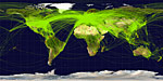
Airplane Flight Routes [1]
Today, a person in the United States can wake up, go to the airport, and fly to almost any place on the planet. If he wanted to, he could move to almost any city, region, state, or country. Today, this type of movement is easy. For most people, if they desire or need to, they can move. In history, movement and travel was more challenging, but had long-lasting effects. In this lesson, we will explore how the movement of people led to the development of cities, the conquering of countries, the spread of cultures, and the development of trade and wealth.
Key Questions
- Why do people move from one place to another?
- How did cities emerge and grow?
- Why did some groups of people conquer and invade other people?
- How did trade routes develop and alter the world?
- How did the movement of people affect cultures throughout the world?
Student Outcomes
- Examine how the migrations of different groups, such as Huns, Bantus, Polynesians, Aztecs, Mongols, Vikings, Magyars, and Arabs influenced different political, social, and cultural ideas and systems.
- Assess the importance of regional and worldwide trade routes, including the Indian Ocean trade routes, as vehicles of economic, religious, cultural, and technological diffusion or distribution.
- Describe the importance of geographic features and trade routes in the development of major urban centers such as Beijing, Bukhara, Canton, Constantinople, Delhi, Malacca, Samarkand, Timbuktu, and Venice.
- Use geographic tools explain how migration patterns and trade routes such as the Indian Ocean trade routes connected most of Afro-Eurasia.
- Draw comparisons across eras and regions in order to define long-term issues as well as large-scale or long-term developments that surpass regional and chronological boundaries. (Historical Thinking Skill)
- Use timelines, bar graphs, pie graphs, charts, and historical maps to evaluate historical data and recognize historical trends. (Historical Thinking Skill)
- Draw conclusions and make generalizations based on the text, multiple texts, and/or prior knowledge. (Historical Thinking Skill)
- Use geographic tools to locate places and describe the human and physical characteristics in the region. (Historical Thinking Skill)
Key Terms
Student Resources
- Push and Pull Factors in Human Migration (doc)
- Historical Investigation - Impact of the Movement of Peoples in History (doc)
- Trade Routes Jigsaw (pdf)
- Trade Routes Jigsaw Organizer (doc)
- Effects of Human Movement Brief Constructed Response (BCR) (doc)
Chart of Activities:
| Activities to Complete | Estimated Time |
|---|---|
| Pre-Assessment | 5 minutes |
| Key Terms | 5 minutes |
| Activator | 5 minutes |
| Opening: Push and Pull Factors | 15 minutes |
| Activity 1: Migrations, Invasions, and Conquests | 10 minutes |
| Activity 2: Migrations, Invasions, and Conquests Knowledge Check | 10 minutes |
| Activity 3: Impact of Human Movement in History | 25 minutes |
| Activity 4: Trading Networks Prior to the 15th Century | 25 minutes |
| Activity 5: Cities that Trade Created | 10 minutes |
| Activity 6: Cities that Trade Created Knowledge Check | 5 minutes |
| Review and Assessment | 25 minutes |
| Lesson Summary | 5 minutes |
Lesson Completion Time
The total estimated time to complete this lesson is 145 minutes.
Page Notes:
[1] Source: This image from http://commons.wikimedia.org/wiki/File:World-airline-routemap-2009.png is licensed under the terms of the GNU License Agreement.
