


Unit 1: Redefining World Society and Culture
Lesson E: Travel and Trade in the Pre-Modern Era
Activity 5: Cities that Trade Created
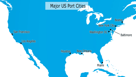
Major US Port Cities
Look at the map above. It shows some major US cities. You should notice that all of them are located along the coast of the United States. Historically, these port cities became large and influential because they grew as a result of trade. In these cities, ships from other countries and parts of the United States arrived to drop off goods, and then left with American goods to ship to other countries. As these cities became centers of wealth and finance, people were pulled to the economic opportunities found in these cities. Port cities and other cities along trade routes gained wealth and population over the years.

Written Activity - Notebook
Examine the map above that shows major United States port cities today. Use this map to help you answer the following questions in your notebook:
- Why do you think that people would be "pulled" to these port cities?
- How might the lives of people who live in major trading cities be different from people who live in smaller and less wealthy areas of the United States?
- How might geography have played a role in the development of these cities?
Directions: In this activity, you will explore some of the cities that developed during the pre-modern world along trade routes. As you read about different cities, take notes on interesting information that you discover about these cities. Pay close attention to what role trade, travel, and geography played in the discovery of these cities.
Alternative content

